
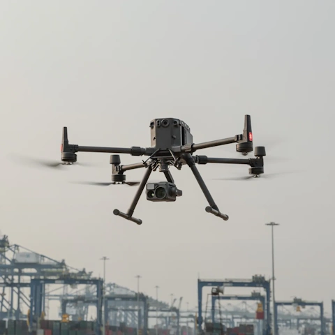
Drone Construction Monitoring

Complete visibility over every stage of your project

Get drone-powered monitoring for building and infrastructure construction across Africa. From progress tracking to 3D modelling and digital twins, we give project teams accurate, real-time data to stay on schedule and on budget.

drone construction monitoring m
Who we work with

Every stakeholder. Complete visibility.

Project managers

Accurate, up-to-date site visibility so every decision is based on real data, not estimations.

Engineers and surveyors

High-precision aerial surveys, 3D models, and geospatial datasets that integrate into your existing workflows.

Developers and asset owners

Independent progress documentation and condition assessments that keep you informed at every stage.

EPC contractors

Regular aerial monitoring that surfaces discrepancies, tracks progress, and keeps your team aligned.

Insurance providers

Documented progress and condition data to support underwriting decisions, risk assessments, and claims.

Where we add value

Drone monitoring across every stage of your construction project

Construction projects, whether buildings, roads, rail, or bridges, present distinct monitoring challenges. Dronet provides targeted data capture and analysis at every stage.

Pre-construction

Site survey

The challenge

Terrain mapping, volumetric analysis, and existing condition surveys using traditional methods are time-consuming, expensive, and often incomplete.

What you get
High-resolution topographic and terrain maps
Volumetric analysis and earthworks calculations
Existing condition survey and documentation

Construction

Progress tracking

The challenge

Discrepancies between design and reality accumulate quietly across multiple workfronts and are always more expensive to fix later than to catch early.

What you get
Progress reports tracked against design specs
3D models and point clouds for precision comparison
Interior and exterior spatial documentation

Commissioning

Digital twin

The challenge

Before handover, as-built condition needs to be accurately verified against design intent. Manual surveys are slow, incomplete, and often miss critical deviations.

What you get
Complete as-built survey documentation
High-accuracy 3D models and digital twins
Interior and exterior condition verified

Operations and maintenance

Facility Management

The challenge

Structural deterioration and surface damage are difficult to track systematically without accurate baseline data and regular inspection across the full asset.

What you get
Periodic condition inspection reports
Updated 3D models and digital twin records
Deterioration mapped to specific locations
The Process

From first contact to final report

Step 1

Project scoping

We understand your project type, scale, and monitoring objectives before deploying anything.

Step 2

Data collection

Aerial drone surveys combined with SLAM for interiors. No blind spots, complete coverage.

Step 3

AI-powered analysis

3D models, point clouds, and progress comparisons generated with accuracy and consistency.

Step 4

Reporting

Structured reports and digital twin outputs mapped to your project documentation.

dronet offices
Why Dronet

We bring more than a drone to every inspection

Drone and SLAM. Inside and out.

Most drone monitoring stops at the exterior. We combine aerial data with SLAM to deliver complete spatial coverage, including interiors, tunnels, and enclosed structures. A true digital twin, not a partial one.

3D modelling that integrates with your workflows

Our geospatial specialists produce high-accuracy 3D models and point clouds that integrate with industry-standard engineering and BIM platforms. Data you can actually use, not just look at.

Built for African project environments

Remote sites, variable terrain, and complex logistics are part of the reality here. Our monitoring programmes are designed around those conditions, not imported from markets where things work differently.

Stay ahead of project risks before they cost you

Talk to one of our experts and find out how drone-powered monitoring and digital twin technology can give your construction project the visibility it needs.